Zanskar to Tso Moriri trek
Duration: 15 days
Difficulty: level 5
Distance: 234 km
Max elevation: 5435m
Elevation gain / loss: +6315m / -5553m
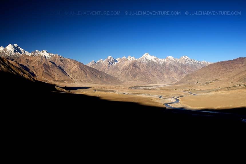
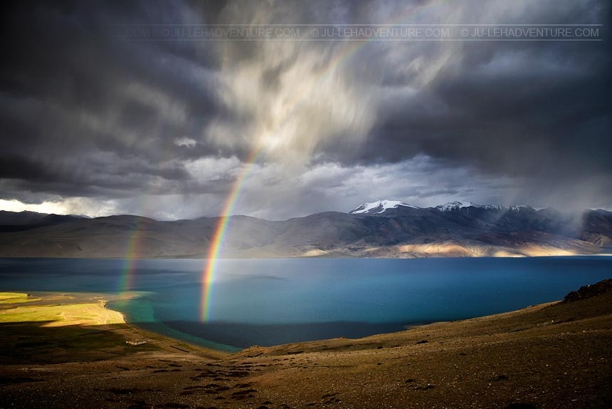
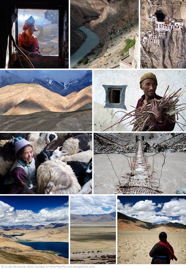
This off-the-beaten-path trek connects the Zanskar valley to the highlands of Changthang region, home to the nomadic people. During the first part of the trek, you will have the chance to discover the local life in remote Zanskari villages as well as visiting Phuktal, one of the most fascinating monasteries. You will then follow an isolated path leading to the Changthang region and you will cross numerous high passes before reaching the beautiful Tso Moriri lake.

Itinerary
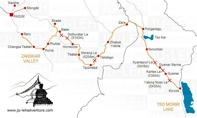
Day 1: Raru - Changpa Tsetan
Time: 5-6 hrs
Distance: 16.0 km
Elevation gain / loss: +379m / -355m
| - | walk along the Tsarap river through a rugged landscape |
| - | cross the river couple of times before reaching Changa Tsetan |

Day 2: Changpa Tsetan - Phuktal
Time: 5-6 hrs
Distance: 15.6 km
Elevation gain / loss: +383m / -280m
| - | walk past the villages of Surle, Kalbok and Zantang to the confluence of Tsarap and Kargyak river and a little ahead is the village of Purne |
| - | walk to Phuktal monastery, the gompa is spectacularly located at the mouth of a huge cave high up in the vertical mountainside |
| - | take your time to visit the monastery |

Day 3: Phuktal - Shade
Time: 7-8 hrs
Distance: 21.3 km
Elevation gain / loss: +392m / -104m
| - | follow Tsarap river up to Yata and walk to the village of Tantak |
| - | enter a small valley leading to the village of Shade, one of the most isolated villages of Zanskar |

Day 4: Shade - Nyalokuntse La Base
Time: 3-4 hrs
Distance: 9.1 km
Elevation gain / loss: +349m / -294m
| - | spend time in Shade village |
| - | walk to Nyalokuntse La base |

Day 5: Nyalokuntse La Base - Nyalokuntse La - Gothurstar La - Hormoche
Time: 7-8 hrs
Distance: 15.0 km
Elevation gain / loss: +1249m / -1579m
| - | long day through beautiful high-altitude landscapes, crossing two passes before reaching Hormoche |

Day 6: Hormoche - Tsatak
Time: 4 hrs
Distance: 13.6 km
Elevation gain / loss: +73m / -0m
| - | as you walk along the river, you will pass through agricultural fields which were abandoned because of climate change |
| - | cross the Zara Chu river that comes from Rupshu valley and reach the pretty village of Tsatak |

Day 7: Tsatak - Tsokmitsik
Time: 4-5 hrs
Distance: 14.9 km
Elevation gain / loss: +84m / -0m
| - | easy walk to reach Tsokmitsik |

Day 8: Tsokmitsik - Morang La - Takstago
Time: 7-8 hrs
Distance: 12.5 km
Elevation gain / loss: +1218m / -763m
| - | cross the Morang La and enjoy the view of the Rupshu valley and Zanskar range from the pass |
| - | steep descent to Takstago |

Day 9: Takstago - Zhabuk Yokma
Time: 6 hrs
Distance: 18.0 km
Elevation gain / loss: +307m / -512m
| - | steep climb for an hour to cross a small pass |
| - | follow the river leading to a meadow surrounded by beautiful cliffs |

Day 10: Zhabuk Yokma - Zara
Time: 7 hrs
Distance: 21.8 km
Elevation gain / loss: +286m / -0m
| - | follow the trail and pass through some small villages before reaching Zara |

Day 11: Zara - Ponganagu
Time: 5 hrs
Distance: 16.8 km
Elevation gain / loss: +53m / -22m
| - | the trail crosses the road going from Leh to Manali |
| - | continue walking towards Ponganagu which is close to Tso Kar lake |
| - | this area is home to many wild animals such as kiang (wild asses), migratory birds, ibex, and marmots |

Day 12: Ponganagu - Nuruchan
Time: 5-6 hrs
Distance: 17.8 km
Elevation gain / loss: +173m / -145m
| - | the trail goes along the bank of Tso Kar lake and then through a barren landscape until Nuruchan |

Day 13: Nuruchan - Kyamayuri La - Gyamar Barma
Time: 7-8 hrs
Distance: 19.3 km
Elevation gain / loss: +855m / -339m
| - | today, you will climb two passes, Horlam Kongka La (4900m) followed by Kyamayuri La (5416m) |

Day 14: Gyamar Barma - Kartse La - Gyamar
Time: 3 hrs
Distance: 5.7 km
Elevation gain / loss: +213m / -251m
| - | ascend slowly towards the Kartse La and then walk down to the Gyamar valley |

Day 15: Gyamar - Yalung Nyau La - Korzok
Time: 5-6 hrs
Distance: 16.3 km
Elevation gain / loss: +340m / -905m
| - | move up towards the Yalung Nyau La, the highest pass on the trek with a magnificent view of Tso Moriri lake |
| - | walk down to Korzok village situated on the bank of Tso Moriri |

Getting to / from the trek
| - | Raru is 20 km from Padum and there is 450 km between Padum and Leh |
| - | it takes 7 hours to drive from Korzok to Leh (215 km) |
It is worth taking some extra time to stop and visit the highlights in the area, check the Zanskar valley tour and the Tso Moriri lake and Indus valley tour for more details.
All the itineraries can be customized to suit your own special interests, preferences and abilities. Please contact us for more information.

 Hemis to Tso Moriri
